Skip to content
Prime RetailGroup

Pipeline

Future development

Development sites, plus conceptual retail projects under early evaluation.

Where we look

Evaluating pads and infill across Kern County growth corridors.

Bakersfield and surrounding Kern County communities continue to add rooftops along corridors like Rosedale, Panama Lane, and the outer edges of Delano and Wasco. Prime Retail Group tracks these areas for landowners and investors weighing whether a parcel is ready for retail, and for retailers looking a few years ahead of their next expansion.

The development sites below come from our current marketing materials. The early-stage concepts further down are evaluations, not entitled or actively marketed projects. If you own land or are considering a pad concept, we can walk through what it would take to get it market-ready.

Development sites

Current development opportunities

Rosedale & Renfro Intersection
Rosedale & Renfro Intersection — photo 2
Rosedale & Renfro Intersection — photo 3
Rosedale & Renfro Intersection — photo 4
Rosedale & Renfro Intersection — photo 5
Available1 / 5

Rosedale Hwy & Renfro Rd · Bakersfield, CA

Rosedale & Renfro Intersection

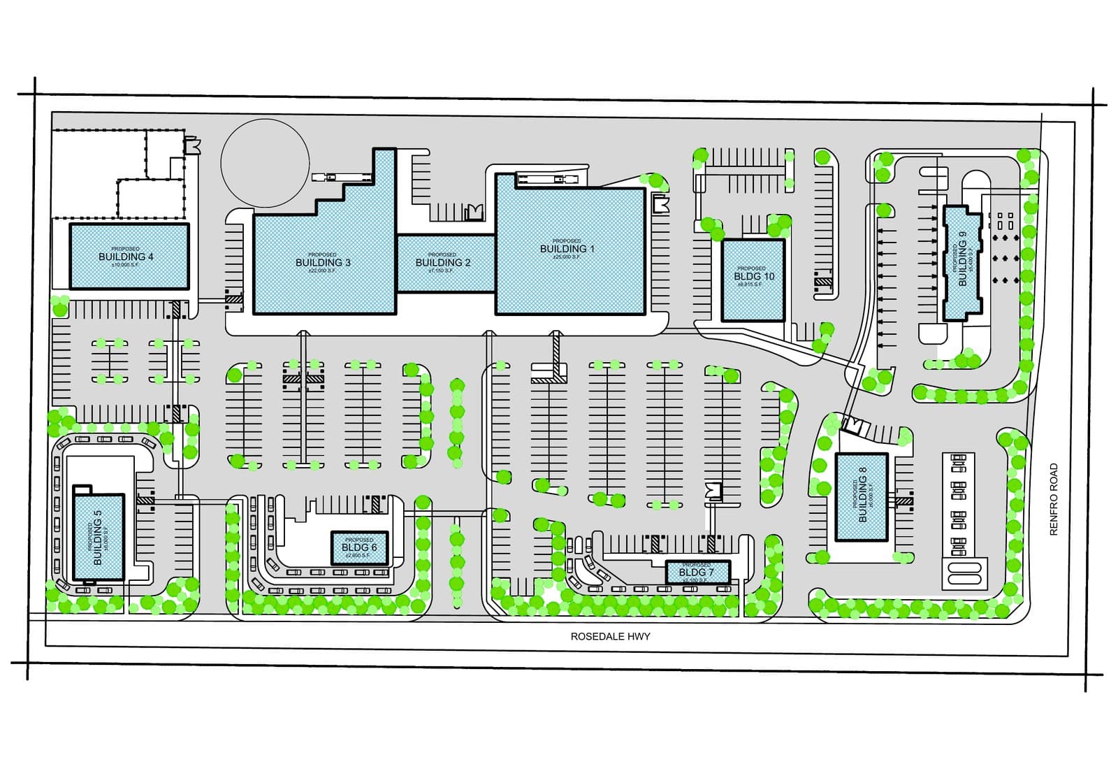
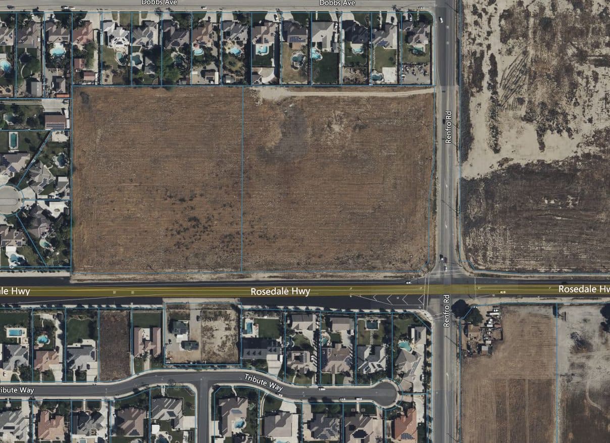
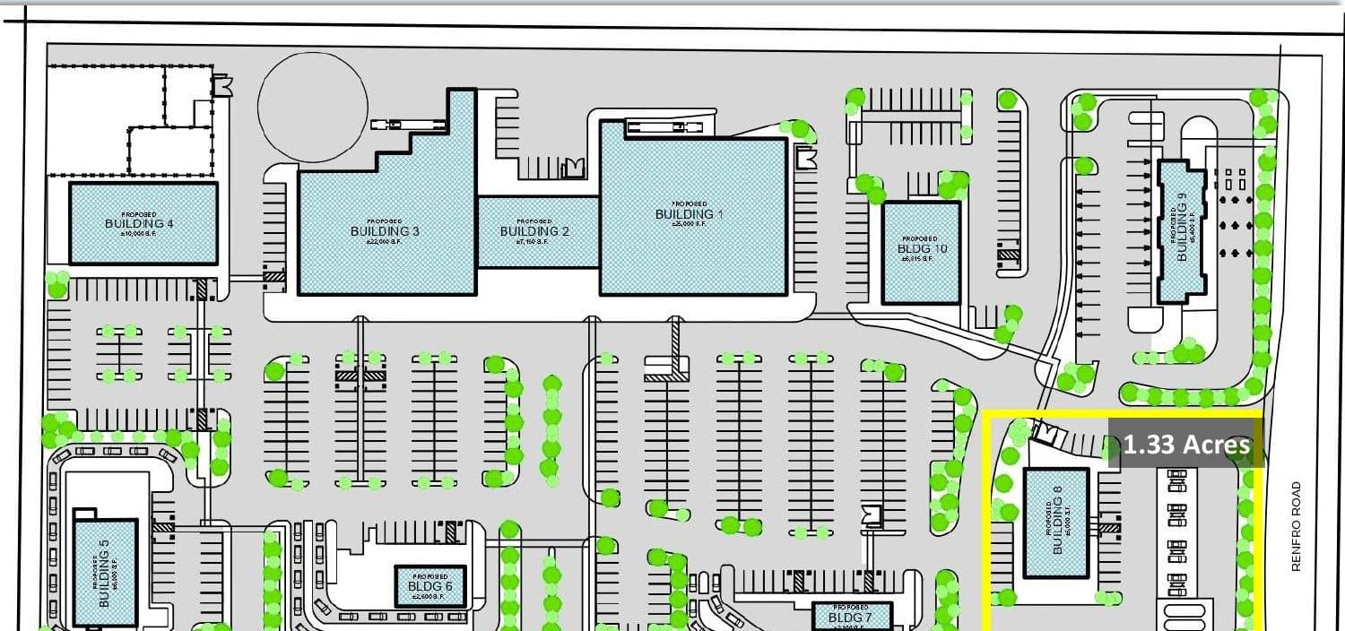
±15.3 acres of commercial land at the signalized intersection of Rosedale Highway and Renfro Road in Northwest Bakersfield, with an entitled site plan for a proposed 10-building, ±90,750 SF multi-use retail development.

Acreage
±15.3 acres (with a separately delineated ±1.33-acre corner pad parcel)
Phase / status
Entitled site plan for a proposed 10-building development · Available
Building area
±90,750 SF proposed (10 buildings)
Planned uses
Retail, food, day care, and car wash pads; ideal for gas station/C-store, fast food, or shopping center users
Existing zoning
C-2PD, Commercial
Proposed zoning
Mixed Use Commercial
Parking
436 total stalls (324 standard, 25 disabled, 87 EV); 21 carwash vacuum stalls
Traffic
4,676 ADT (Renfro Rd)
Nearby growth
Approved development of 378 new housing units on Renfro Road at Brimhall Road
Offering price
Call for details
Proposed building data
Building 1Retail25,000± SF
Building 2Retail / Food7,150± SF
Building 3Retail22,000± SF
Building 4Day Care10,000± SF
Building 5Food6,000± SF
Building 6Food2,600± SF
Building 7Food2,100± SF
Building 8Retail6,000± SF
Building 9Car Wash5,400± SF
Building 10Food4,500± SF

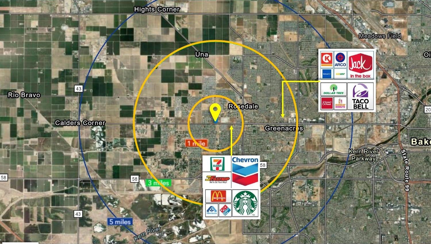
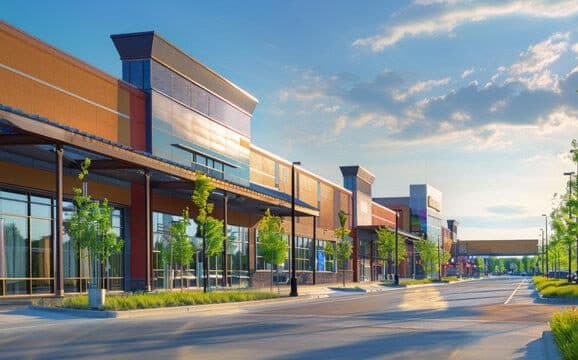
Images: Overall site plan of the entire project, aerial, site plan with the ±1.33-acre corner pad, trade area, and conceptual rendering (for illustrative purposes only, not to scale).
N Highway 65 — Signalized Hard-Corner Land
N Highway 65 — Signalized Hard-Corner Land — photo 2
N Highway 65 — Signalized Hard-Corner Land — photo 3
N Highway 65 — Signalized Hard-Corner Land — photo 4
Available1 / 4

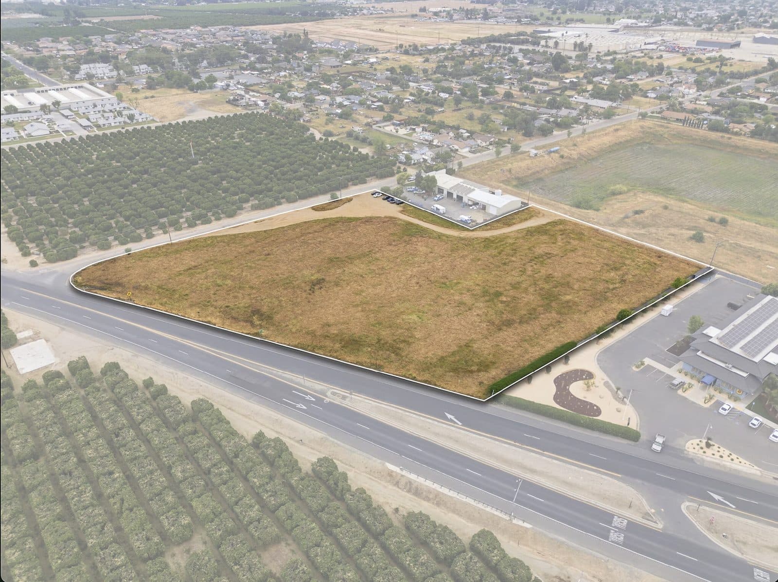
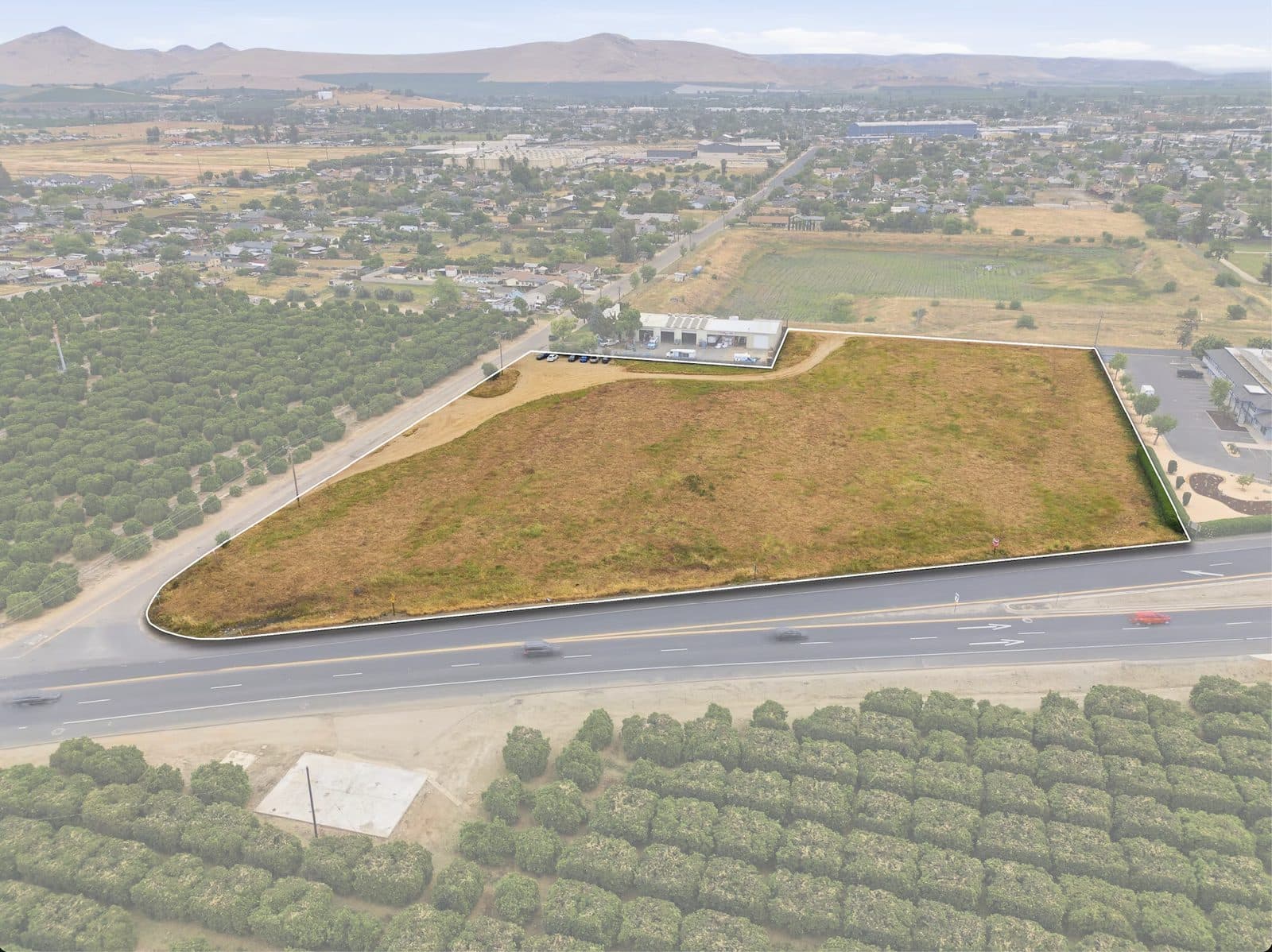
State Hwy 65 & W. Mariposa St · Lindsay, CA

N Highway 65 — Signalized Hard-Corner Land

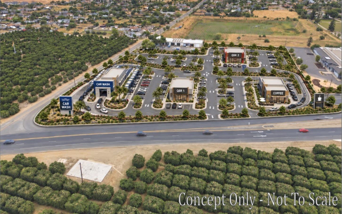
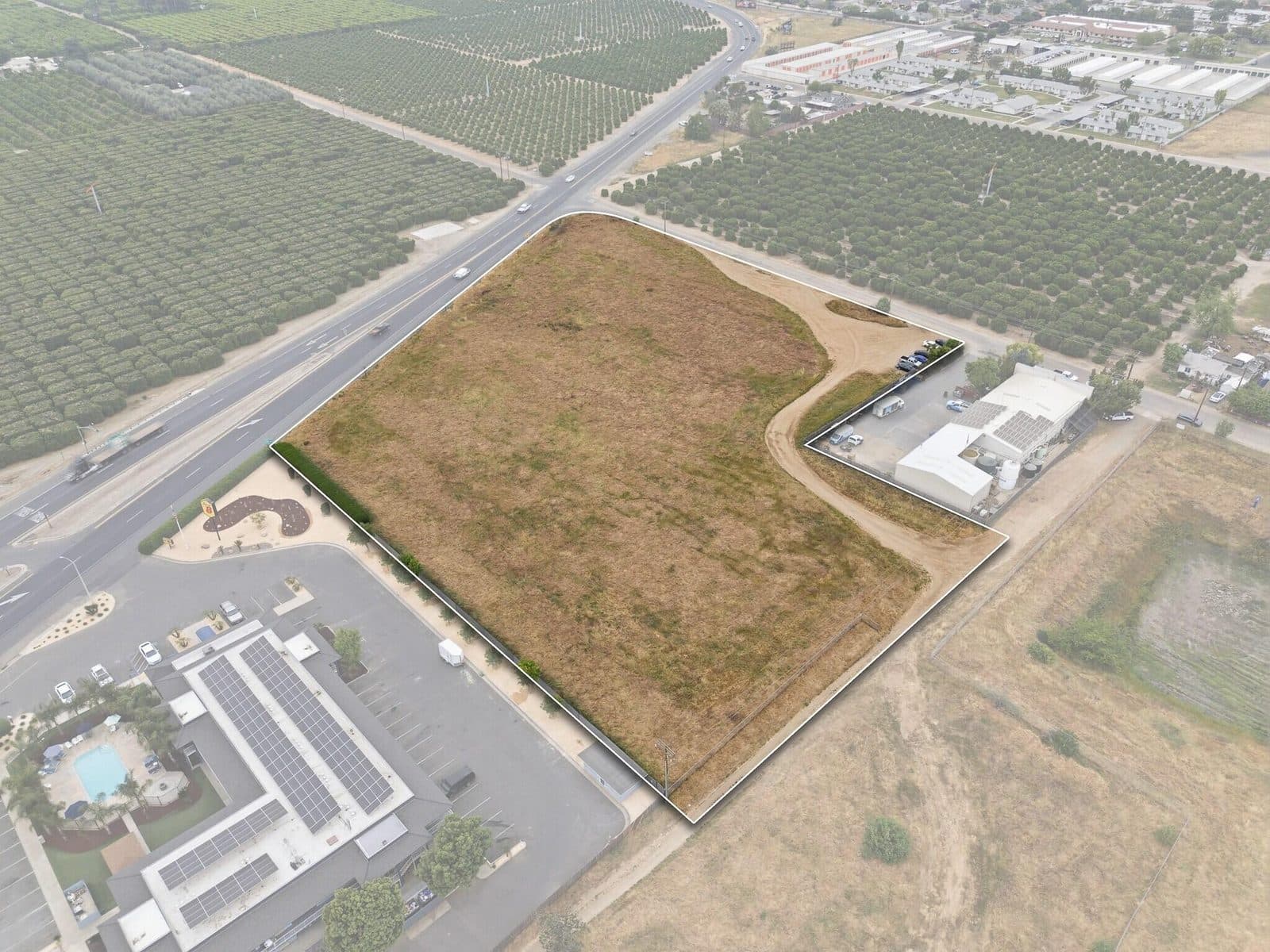
A commercially zoned parcel at a signalized hard corner on State Route 65, with flat, buildable topography and frontage on a high-traffic corridor — suited to land banking, development, or build-to-suit.

Acreage
±4.73 acres
Phase / status
Available
Planned uses
Ideal for retail, service-based businesses, fuel, or mixed-use commercial development; proposed use: Commercial
Zoning
C-H – Highway Commercial
Property type
Land · Commercial
Traffic
SR 65 through Lindsay carries an average of approximately 27,000 vehicles per day
Price
Contact broker
Timeline
Corridor: Caltrans and the Tulare County Association of Governments plan a new roundabout at SR 65 and Tulare Road; construction is scheduled to begin in fall 2026 and finish in fall 2027.

Images: Concept site plan of the project (concept only, not to scale), then drone aerials of the land.

Visalia — 13 Acres

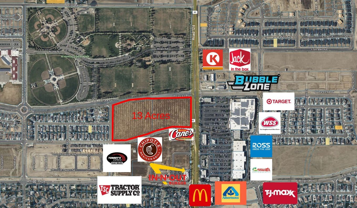
W Riggin Ave & Road 124 area · Visalia, CA

Visalia — 13 Acres

A 13-acre site in Visalia shown with the surrounding retail on the site aerial. Contact us for planned uses, phasing, and timing.

Acreage
13 acres

Images: Site aerial; logos mark existing nearby businesses.

Information is from our marketing materials and is deemed reliable but not guaranteed; verify during due diligence.

Early-stage concepts

Southwest Retail Pad Pipeline

Site planning

Southwest Retail Pad Pipeline

Stine Road Corridor, Bakersfield

Conceptual pad opportunity near established traffic generators. Suitable for QSR, service retail, or medical-adjacent use.

Ming Corridor Infill Concept

Early diligence

Ming Corridor Infill Concept

Ming Avenue Area, Bakersfield

Neighborhood retail infill concept under early evaluation — not an offering unless and until marketed.

Rosedale Growth Corridor Concept

Conceptual

Rosedale Growth Corridor Concept

Rosedale Highway, Bakersfield

Early-stage look at pad and small-shop potential along a growing rooftop corridor — conceptual only, no active entitlements.

Delano Corridor Pad Concept

Conceptual

Delano Corridor Pad Concept

Delano, Kern County

Preliminary evaluation of pad and inline retail potential to support a growing Kern County community — not yet marketed.

What we look for

From raw site to market-ready pad.

01

Site & market planning

We start with traffic counts, rooftop growth, and co-tenancy potential to judge whether a site or corridor can support retail before anything is marketed.

02

Diligence

Zoning, access, utilities, and basic feasibility are reviewed alongside comparable rents and sale pricing for the corridor.

03

Marketing & positioning

Concepts that clear diligence move to active marketing — pad packaging, broker outreach, or a listing, depending on the owner's goals.

Have land or a pad concept to discuss?

Contact us →